Playing Hide and Seek
The Big Trip - Day 1
On Saturday, May 19, 2012, with high levels of anticipation and excitement Deb and I pulled out of our driveway — our “big trip” had begun. As I headed towards the freeway I ran through the several checklists of items we needed to bring and tasks we needed to perform. Green light, all items packed and our rig and ourselves were ready. I mashed the accelerator as I turned onto the freeway on-ramp. Next stop Las Vegas, Nevada.
This first day was merely a travel day. We had no activities or photo stops planned. Our sole goal was to reach North Las Vegas and find a spot to spend the night. The real trip would begin on Sunday which is when the annular eclipse would be occurring.
It happened as we climbed Cajon Pass on Interstate 15 North. I could tell something wasn’t quite right as the turbo fully-engaged on our Ford F-250 truck just as we leaned into the steepest part of the grade. The turbo was making a very discernible high-pitch whining noise. As I backed off of the accelerator the noise dropped away.
“Bummer,” I said aloud, “this could be bad.”
We were just getting started and now we have an issue. Not a very satisfying feeling to be sure. However, once we crested the summit the noise abated. I called my good friend and talked to him about the situation. He was kind enough to do some research and would get back to me. I continued on, thinking that perhaps our rig was just really heavy at this point with full tanks and stores aboard. I reasoned that the vehicle would get lighter as we progressed northward. I also decided to go easy on the truck as well. After all we were on vacation, so no hurry.
We cranked up the tunes and the AC and settled into a rhythm as we passed through the desolate towns on I-15 between Barstow and Las Vegas. The long grade eastbound out of Baker presented no problems for us and I did not hear the turbo noise like before. My concerns about it became a distant memory.
Eventually we settled on spending the night at a truck stop or “travel center” adjacent to the Las Vegas Motor Speedway which is 12 miles north of downtown Las Vegas. Fortunately there were no races being held at the time as the noise would have made for a rough rest stop.
The Big Trip - Day 2
Sunday marked the day of the eclipse. I had selected a viewing location at Barclay, Nevada. The spot was about 175 miles from where we spent the night in North Las Vegas, Nevada and the route would take us through Caliente, Nevada and along the Union Pacific’s Caliente Subdivision.
We headed north on US Highway 93, The Great Basin Highway, and admired the beauty long the way. I always enjoy taking a road for the first time and seeing new sights. The road, a two-lane undivided highway, was well-maintained and had very little traffic which made the experience that much more enjoyable.
Caliente, Nevada
After three hours or so, we reached the railroad town of Caliente, Nevada. This is where I planned to chase the UP’s Caliente Sub until we reached Barclay. A quick glance at the GPS and I found the road I was searching for — Clover Canyon Road. Based on the information I gleaned from the internet, eventually this road would turn into Clover Creek Road, a gravel/dirt road, and roughly parallel the tracks toward Barclay.
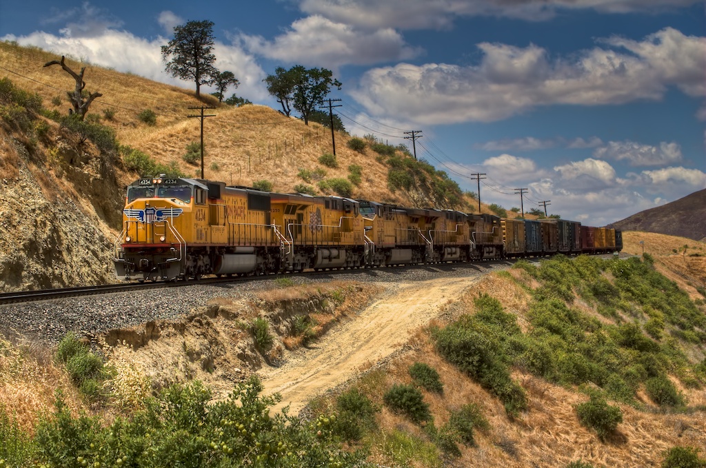
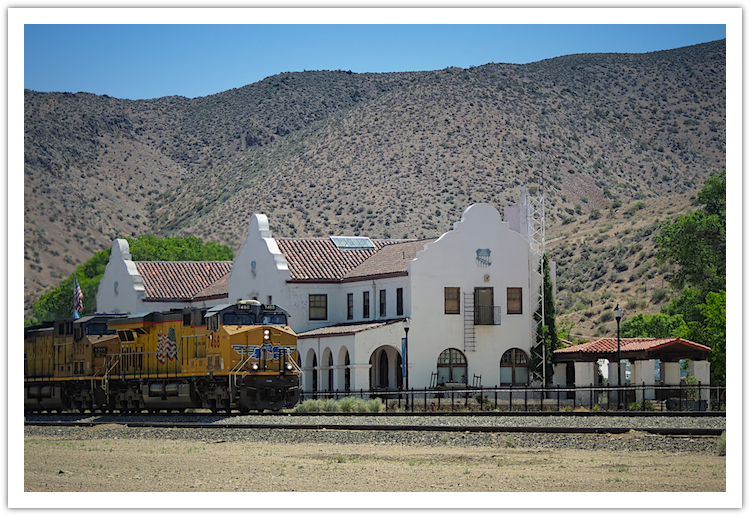 During a brief stop in Caliente, Nevada, Deb caught this westbound coal train pass the old Union Pacific Depot which was built in 1923 to replace a wooden depot that burned down. It now houses a museum and local offices.
[5/20/2012] © Copyright 2012, ChasingSteel.com.
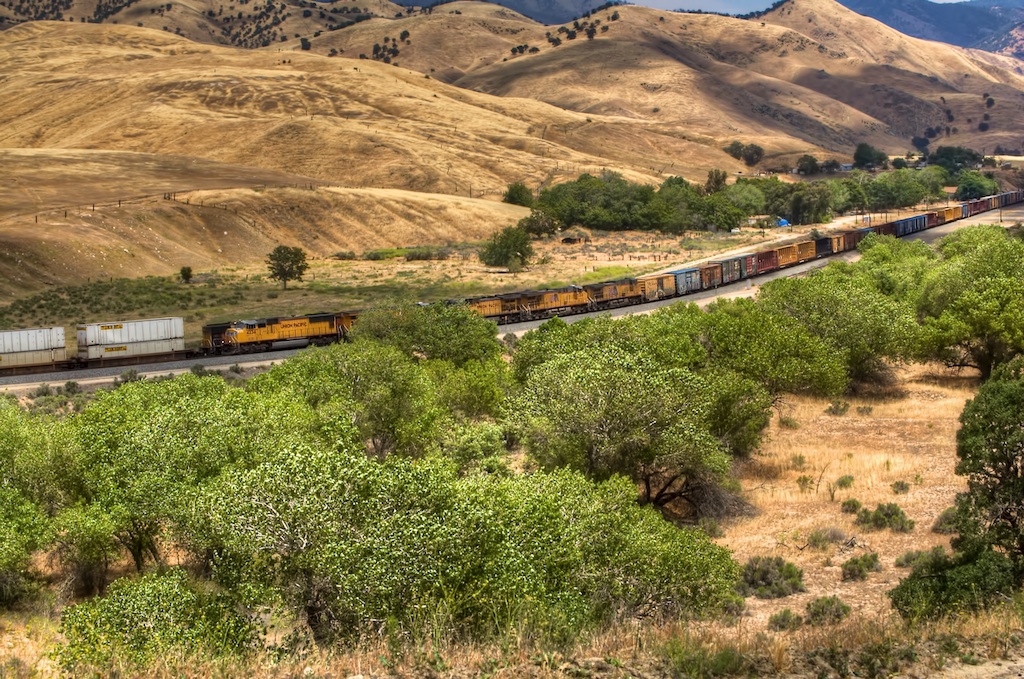
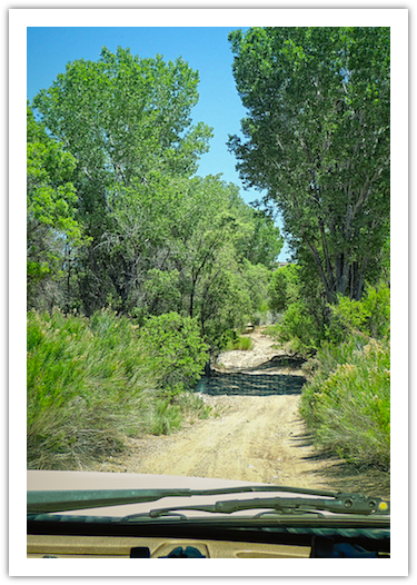 Deb’s view of a more modest part of Clover Creek Road.
[5/20/2012] © Copyright 2012, ChasingSteel.com.
Clover Creek Road
Initially I was optimistic that we would be able to pick our way through the ranches and pastures that lined the road because it appeared to be sufficiently-used by the locals. Soon, however, I began to realize that the actual route of the road did not match up with either the GPS nor the topographical maps that I had of the area. Despite this fact we were still able to proceed more or less in the direction of Barclay so we continued on.
At this point the road began to crisscross what I assumed was Clover Creek itself all the while still roughly paralleling the UP trackage. The UP trackage would disappear from view now and again as the road dodged vegetation and the runoffs that feed Clover Creek.
The area was marked by cliffs of what appeared to me as sandstone forcing the UP tracklayers to make use of tunnels along this portion of the route.
This road was unlike most roads I drive when chasing steel in the southern California. This area had lush vegetation and water! It was fun to watch the schools of tadpoles bolt out of the way as our truck crossed the creek.
Tunnel 12 - Caliente Subdivision
Eventually the road became much too sandy and narrow for me to feel comfortable that we could use it to gain access to Barclay. I decided, after coming close to getting buried up to our axles in sand, to head back the way we came and take a tamer route towards Barclay. Unfortunately this other route would not parallel the tracks at all so we decided to lay up at one of the tunnels we passed earlier so I could take a break and get a few shots before leaving the UP and the Clover Creek Canyon area behind us.
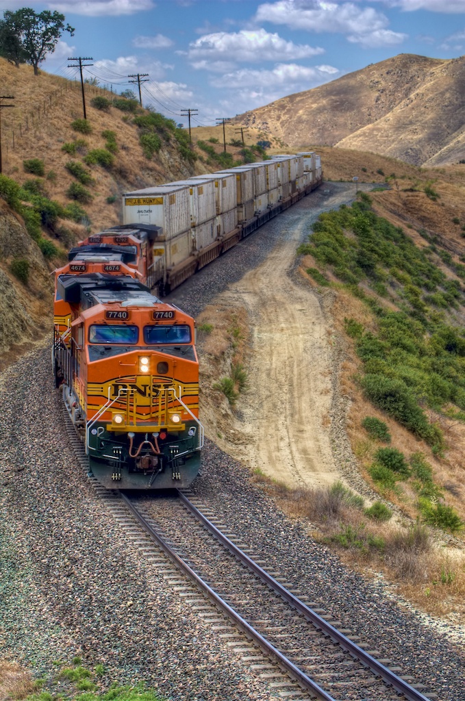
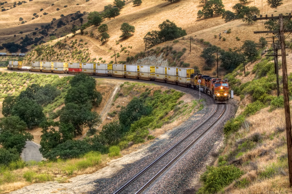
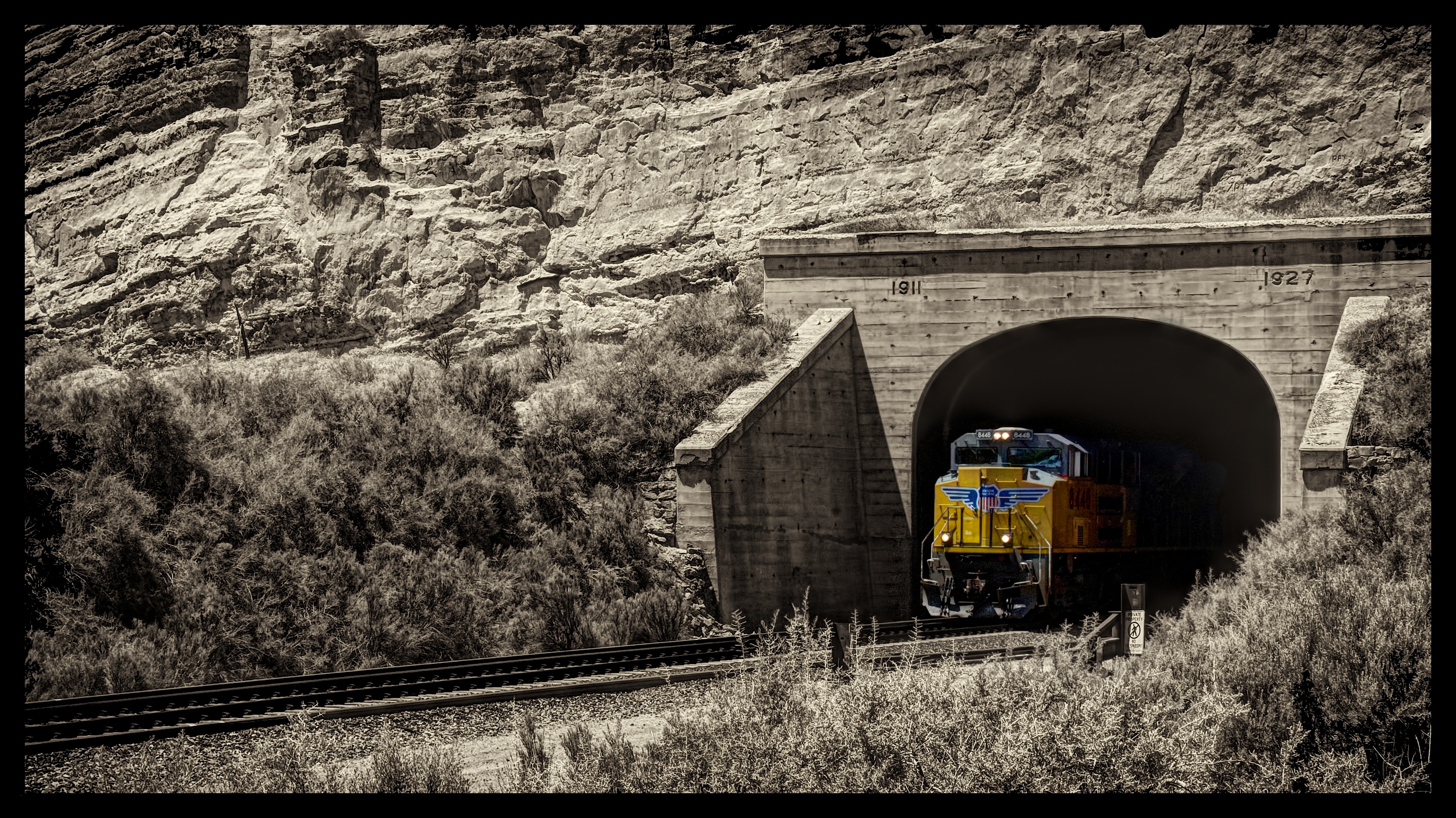 Tunnel Surprise - UP 8448 (EMD SD70ACe) is the lone front-end power on this eastbound stack train roaring out of Tunnel 12 on Union Pacific’s Caliente Subdivision. The train was nearly upon us before we heard it.
[5/20/2012] © Copyright 2012, ChasingSteel.com.
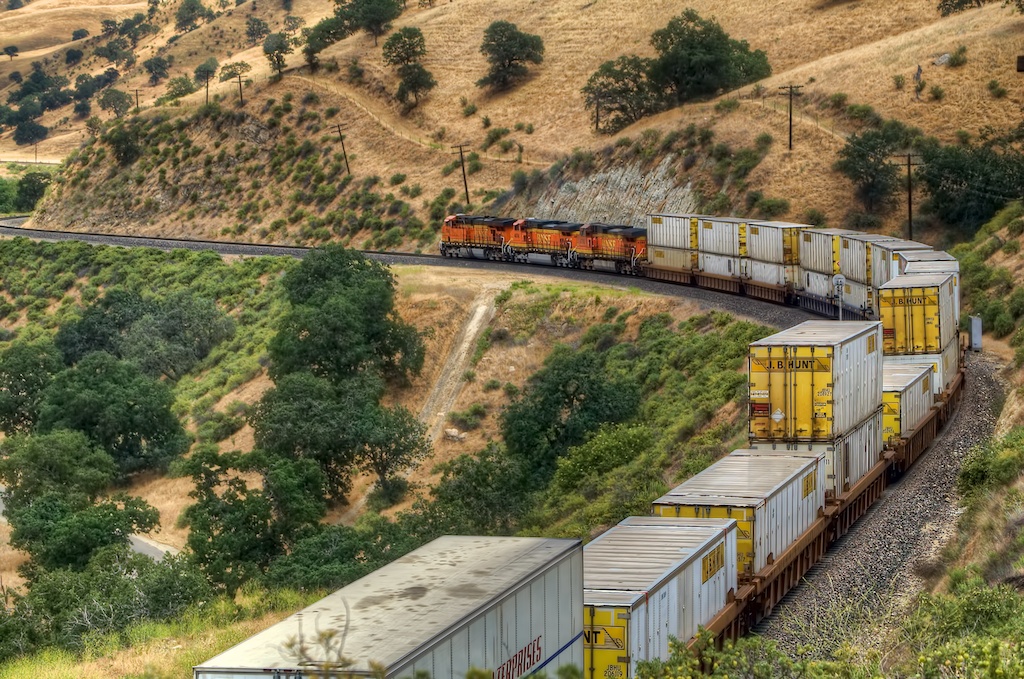
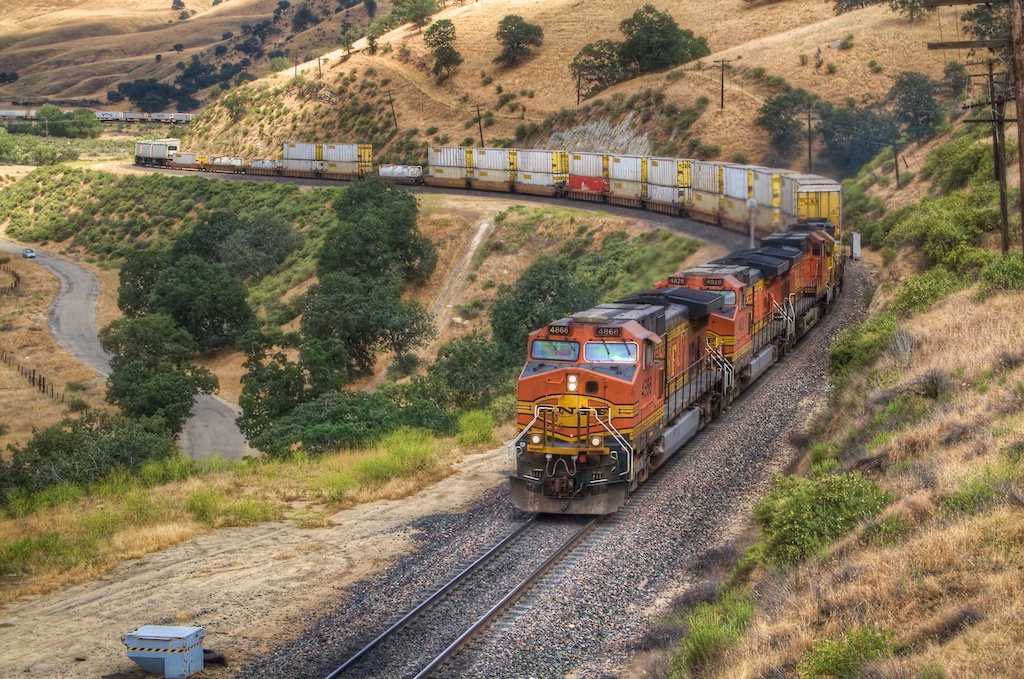
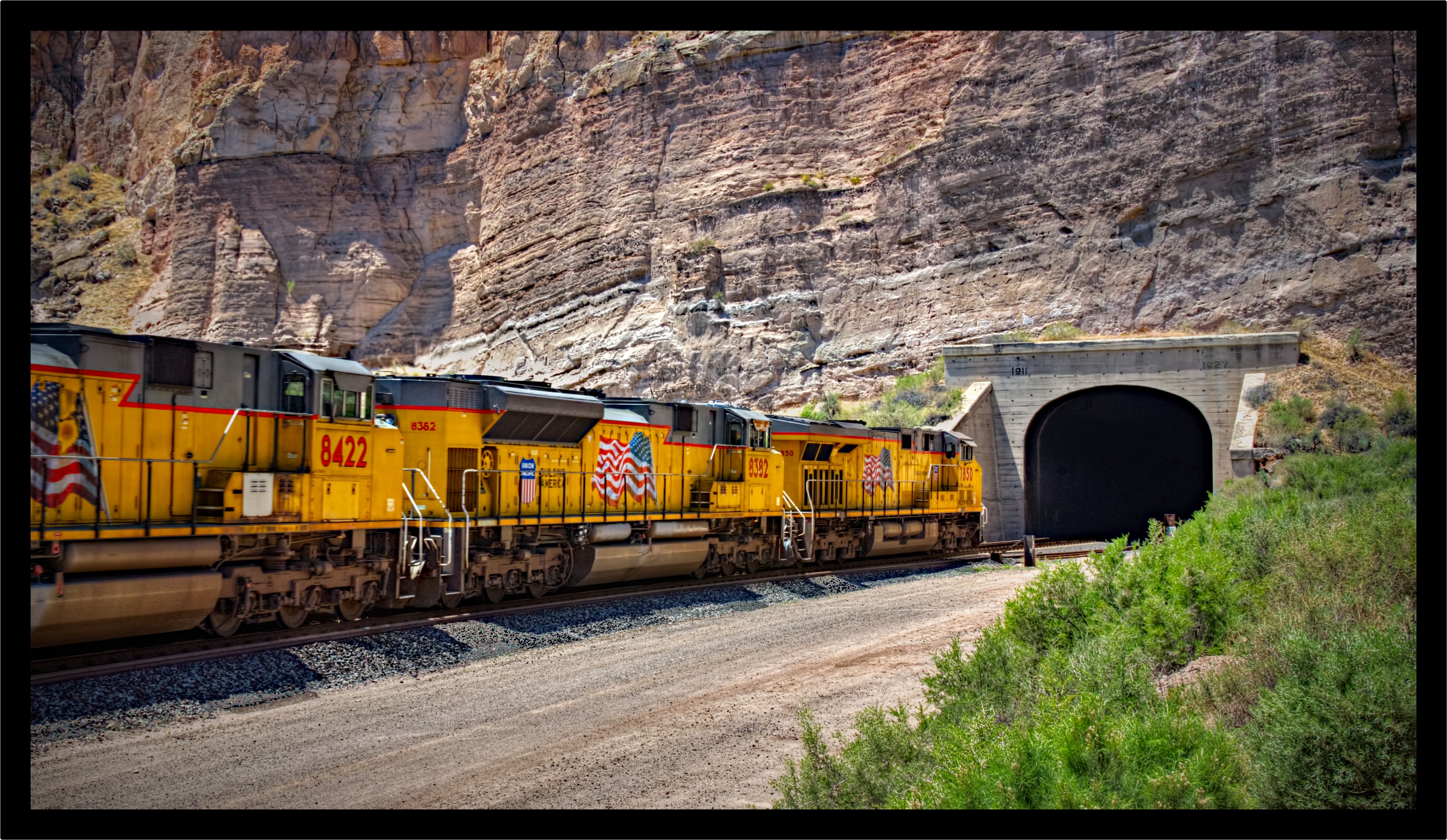 UP 7850 West - UP 7850 (GE AC45CCTE), UP 8382 (EMD SD70ACe), and UP 8422 (EMD SD70ACe) hustle this westbound stack train into Tunnel 12 on Union Pacific’s Caliente Subdivision.
[5/20/2012] © Copyright 2012, ChasingSteel.com.
Plan B - Pick a Spot, Any Spot
It was now fast approaching afternoon at this point and I had yet to locate any spot to use as a location to witness the eclipse. Fortunately I had done some pretty exhaustive research, albeit from 30,000 feet with Google Maps, before the trip and I had some alternative locations in mind. We headed back to Caliente and turned north onto Highway 93 once again looking for Beaver Dam Road.
Beaver Dam State Park is a location that I thought would make a great place to spend the night after we took in the eclipse. The park is best described in this excerpt from the Nevada State Parks Guide brochure:
Beaver Dam State Park is eastern Nevada’s most remote park - its primitive and rustic character will impress nature enthusiasts and hikers alike. The immense 5,500-acre park borders Utah and isapproximately 34 miles east of Caliente. Its primary features include deep canyons, pinon and juniper forests, a tranquil stream and numerous beaver dams. The park offers fishing, camping, picnicking,hiking, photography and nature study. Facilities include campgrounds, a group use area, a day use picnic area, and hiking and interpretive trails. Beaver Dam is located six miles north ofCaliente on U.S. 93, then 28 miles east on a graded gravel road. The park is open all year, but travel may be hampered in the winter.
We headed towards the park keeping an eye out for any rail-centric vantage points along the way. Despite crossing the UP trackage further down Beaver Dam Road at a location known as Acoma, Nevada. I decided to keep going as I felt that location was not ideal. (In hindsight it probably would have worked out just fine as the sun was higher in the sky than I thought it would be.)
Eventually we reached the Beaver Dam State Park and found it at the bottom of a steep-sided valley. The area was like the description from the brochure and we found the campsites perched throughout on the side of the hill. We had evaluated the park and opted not to reserve a site at this point because we wanted to remain flexible in our plans and the park had few campers during our visit so we weren’t concerned about it filling up at night.
Having not found a favorable site yet I decided to go to a location that I was certain had a clear view of the sky and still presented an opportunity for rail traffic. That location was Modena, Utah. To get there we would have to traverse the access roads of the Dixie National Forest west of Enterprise, Utah. It was nearly 4:00PM and I was sweating whether or not we would even see the eclipse.
I drove safely but quickly as I was unsure of the route being passable. We enjoyed the scenery along the way which was dominated by various varieties of pine trees. It was a welcome reprise from the startling, yet beautiful, scenery of the high desert that we drove through around Caliente.
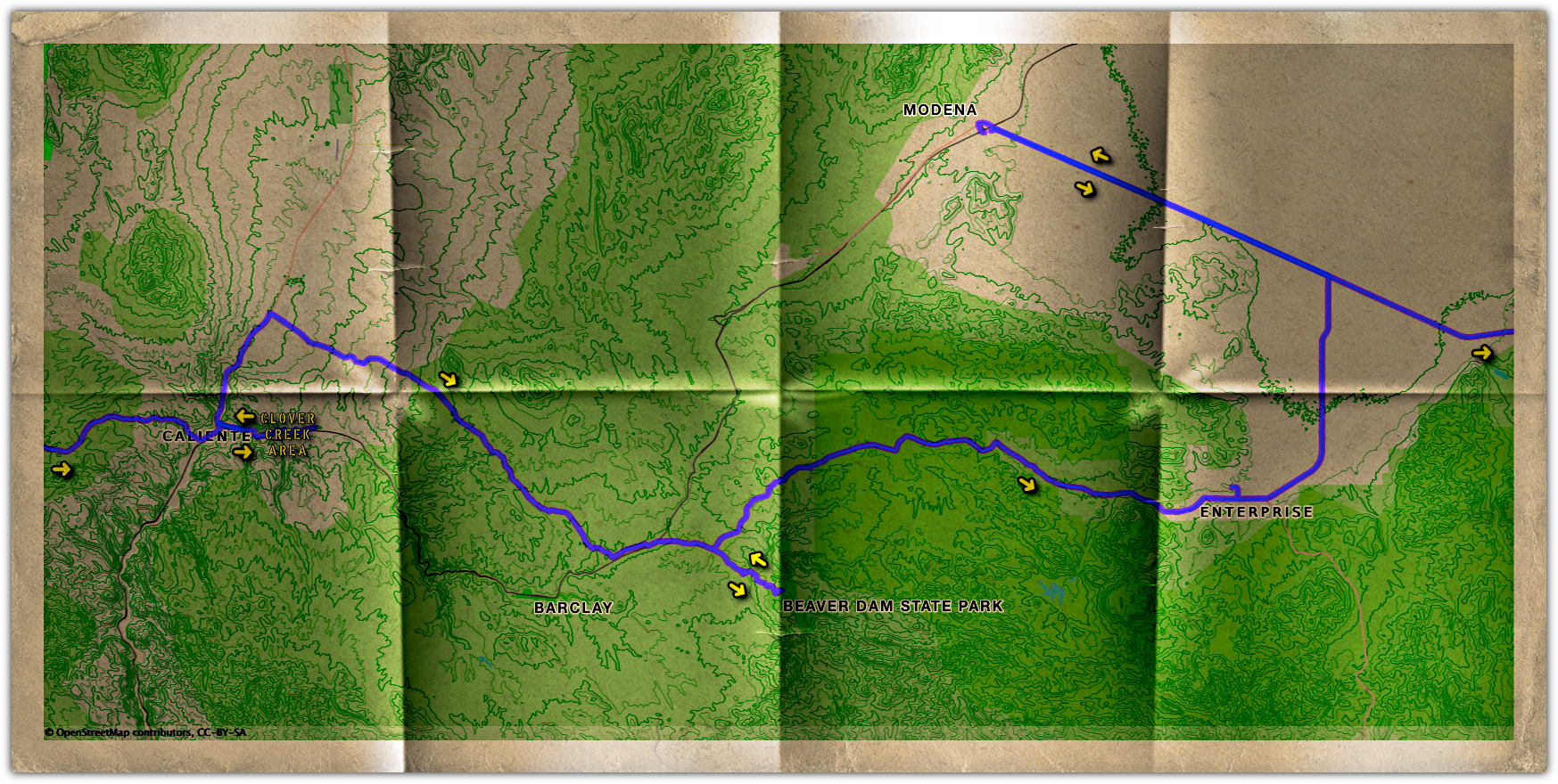 Day 2 Detail Map- Map showing the areas we traversed on day 2 of our “big trip.”
[5/20/2012] © Copyright 2012, ChasingSteel.com.
At Long Last…
We reached the area around Enterprise in relative short order and I welcomed the paved roads that now pointed the way out of the mountains. The land gave way to rolling ranches and farms and the area unmistakably suggested that we were no longer in Nevada. It seems as though everything in Utah is just a bit different. What a gorgeous state!
Soon we had our truck pointed towards the setting sun as we raced along Utah Highway 56 west to Modena. We began to see more and more cars pulled off on the side of Highway 56, on either side. The occupants and their families were busily preparing their telescopes and viewing equipment — eager to capture the eclipse same as us.
When we reached Modena I circled around small enclave of aged buildings that constitute the makeup of Modena and settled on a somewhat railroad-centric location east of the tracks with a water tower prominently positioned in the frame. This was not the view I had hoped for as the tracks ran perpendicular to the setting sun rather than parallel to it. Nonetheless here we were — at long last.
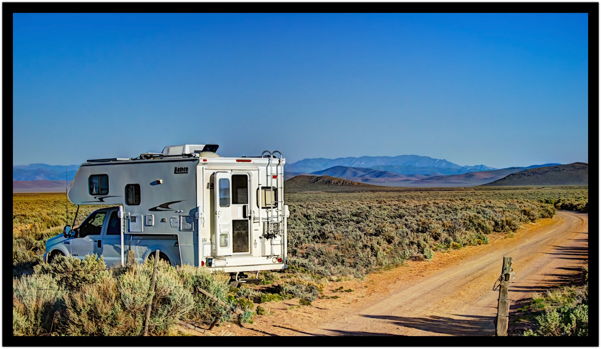 Our Rig at Modena
[5/20/2012] © Copyright 2012, ChasingSteel.com.
We had less than an hour before the beginning of the eclipse so I took a much needed rest after we got something to eat. I think I rested a bit too long because once I got a pair of binoculars securely affixed to the rear of our camper with some photo clamps and appropriately positioned I saw the eclipse was already underway!
Deb and I sprang into action. I positioned myself against a sign post for stability, as my tripod was still buried in the cab of the truck, and began to shoot bracketed exposures for an HDR image. I hoped for, but never got, a train to enter the scene during the entire eclipse. In fact, for the few hours we were there we only saw one train pass by.
I Am Sorry Deb
During the eclipse it became apparent that I had not fully prepared for the eclipse properly. I was interested solely in photographing rail stuff during the eclipse and not the eclipse itself. As such I neglected to realize that Deb was more interested in actually “seeing the eclipse occur” as one would with a proper telescope with a solar filter attached. I should have made sure that Deb had the right equipment and filters to enjoy the experience. I felt bad as she watched the eclipse occur basically through the binoculars projecting the image onto the rear of our camper. Safe, but not the way an amateur astronomer, such as herself, wants to do it. I am sorry Deb, I’ll make it up to you.
End Product
Below is the image I got during the height of the eclipse. There is no train, nor tracks, but there is a water tower. Not the image I envisioned myself getting but I like it nonetheless. I’ll do much better next time because now I know much more about what to expect and do:
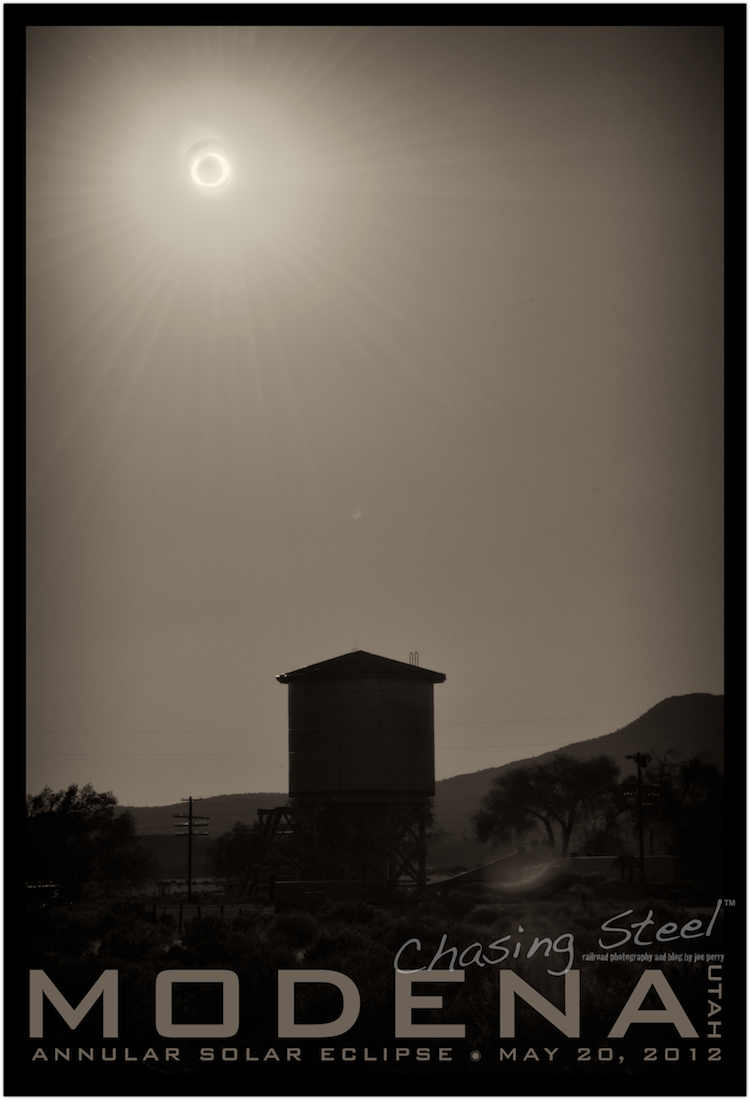 ANNULAR SOLAR ECLIPSE at MODENA, UTAH
[5/20/2012 - Caliente Subdivision] © 2012 Joe Perry. All rights reserved.
NOTE: An interesting phenomenon occurred during the apex of the eclipse. Crickets could be heard starting to do what crickets do at night. After the eclipse passed the crickets stopped. I bet they thought that was the shortest night ever!
 Events, General Photography, Railroad Photography, Ramblings and Such